Geological and Bioregional Assessments (GBA) Explorer
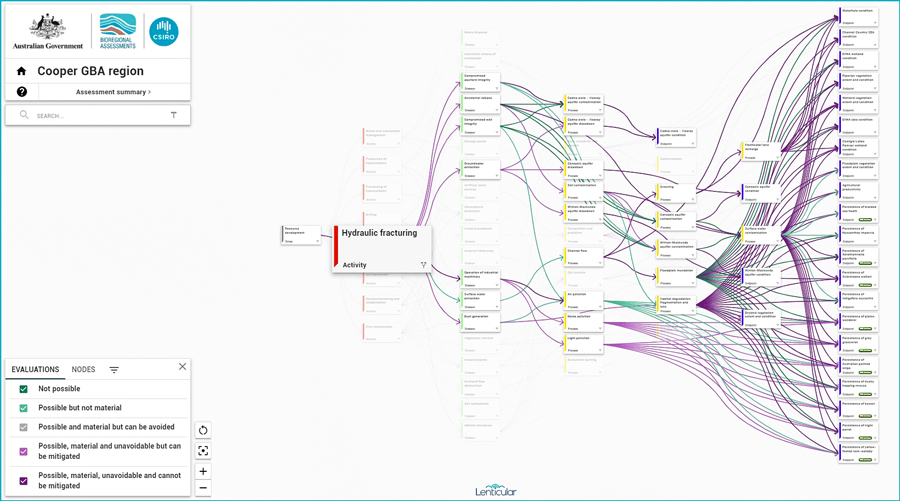
The Geological and Bioregional Assessments (GBA) Explorer is an interactive visualisation of the cause-and-effect relationships between unconventional gas resource developments and environment and water-related matters within the Beetaloo and Cooper GBA regions.
The graphical presentation provides immediate access to node descriptions, link evaluations and an overall assessment summary. Users can visualise the entire causal network or simplify it by selecting specific pathways. Spatial data are also presented via interactive maps that include the spatial information used to inform the assessment and spatial impact maps.
Results are presented at a regional scale and are not a substitute for detailed site-specific assessments required under state, territory or Commonwealth law. The GBA Explorer provides decision makers with a shared understanding of the key environment and water-related matters that need more detailed investigation and the control measures that can be used to manage potential risks.

GBA Explorer was developed through Stage 3 of the Australian Government’s $35.4 million Geological and Bioregional Assessment Program.
The Geological and Bioregional Assessment Program assesses the potential impacts of shale and tight gas development on water and the environment. This work provides independent scientific data, advice and information to governments, industry, land users and the community.
The Australian Government selected the following regions for assessment:
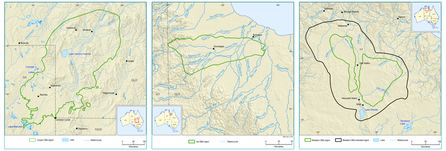
- The Cooper GBA region, which spans south-west Queensland and north-east South Australia
- The Isa GBA region, which covers parts of north-west Queensland, extending east from the Northern Territory border
- The Beetaloo GBA region, which lies south-east of Katherine in the Northern Territory.

These assessments examined the potential impacts on water, the environment, protected areas and threatened species from shale and tight gas resource development and considered appropriate mitigation and management approaches. The approach taken for this assessment was the development of a causal network. This approach allows for a transparent, consistent, and systematic evaluation of the relationship between development activities and the environmental values in each of the GBA regions.
The program outputs include geological and environmental data, tools and knowledge to assist regulators and industry with planning, assessment and reporting. It also provides regulators and industry with a common information base to help inform decision-making and enable the coordinated management of cumulative impacts.
Who are the GasFields Commission Queensland?
Established as an independent statutory body in 2013, the Commission’s purpose is to manage and improve the sustainable coexistence of landholders, regional communities and the onshore gas industry in Queensland. The Commission manages sustainable coexistence in petroleum and gas producing regions of Queensland, and will continue to do so as the industry expands into new and emerging basins.
Our vision is to achieve thriving communities in areas of gas development that are free from discord and supported by well-informed, respectful and balanced stakeholder relationships.
One way the Commission is endeavouring to realise this vision is by providing transparency and independent assurances that the onshore gas industry is appropriately regulated and held to account when needed. This in turn will help cultivate sustainable coexistence, whilst ensuring community and landholder confidence in the regulators and gas industry increases.
Drawing on its wealth of experience in the development of the gas industry and by collaborating with other relevant entities, the Commission provides a range of support to communities and landholders, primarily through education and engagement. These education and engagement activities occur with individual landholders via Commission facilitated webinars, information sessions, publications (The Gas Guide, Shared Landscapes Reports), face-to-face meetings and public workshops.
It should be noted that the Commission does not engage in individual negotiations between landholders and gas companies, but rather provides communities and landholders with the information and support they need to make informed decisions and achieve good outcomes.
![]()
![]()
![]()
![]()
![]()


